
Witham Meadow - a village asset
On the west bank of the River Witham, in the village of Long Bennington, lies Witham Meadow, a small nature reserve held in trust by the Long Bennington Parish Council for the enjoyment of the public. Once part of a whole system of productive agricultural land, some of which is still in use on the opposite bank, the Witham Meadow site is an old floodplain meadow that surrounded the Bennington Mill to supply grain, hay and grazing, contributing to the wealth of the rural community. Today, Witham Meadow is still rich in grass species and wildlife with loam and clay soils, fertile from naturally high groundwater. Natural habitats are being developed on this flood meadow by planting woodland of Willow and Alder trees (known as ‘carr’) and an assortment of native specimen trees to enrich the site and provide a natural beauty.
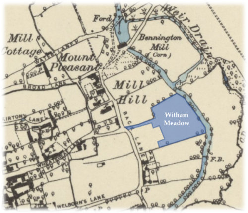
Witham Meadow Historical Map
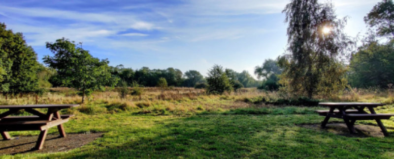
The aim of the Witham Meadow Development Group is to provide a green space as a refuge for wildlife and access to nature for the young and old alike. It is a peaceful haven to find mindful calm away from the everyday bustle of our busy digital age. Access is easy for all abilities - the entrance gate is at the junction of Back Lane, Wheatsheaf Lane and Witham Road with an easy access path and level trail mown around the meadow with recently installed picnic benches and an amenity bin for litter.
There are many opportunities to improve the site and the Development Group would like to hear from people interested in volunteering for upkeep and improvement. Get in touch on parishclerk@longbenningtonparishcouncil.org or ring the Parish Clerk on 01400 282716.
Site Description
Ownership & Management: Held in trust by Long Bennington Parish Council
Location: Junction of Back Lane, Wheatsheaf Lane and Witham Road,
Long Bennington, NG23 5DS.
Coordinates: 52°59'55.1"N 0°45'15.5"W
OSGB36 Grid ref: SK 8370145317
Conservation Status: Nature Reserve adopted 2015